
Najpierw słyszysz, jak zmienia się dźwięk. Idziesz nasypem, mijasz szpaler starych grabów, a potem wchodzisz w cień bramy i nagle robi się cicho — tą szczególną ciszą, którą trzymają w sobie grube, ceglane mury. Powietrze stygnie o kilka stopni. Pod stopami chrzęści żwir, gdzieś kapie woda, a światło, które przed chwilą było szerokie i letnie, teraz wpada do wnętrza wąską smugą przez strzelnicę. To pierwsze, czego forty Krakowa uczą oko i ucho: że obronność była przede wszystkim sztuką panowania nad przestrzenią, światłem i ciszą.
Interaktywna mapka: https://forty-twierdza-krakow.pplx.app
Wokół Krakowa rozsiane są dziesiątki takich miejsc. Tworzą jeden z największych i najlepiej zachowanych zespołów fortyfikacyjnych w tej części Europy — Twierdzę Kraków. To nie pojedynczy zamek ani jedna reduta, lecz cały system: rozłożony na ponad pięćsetkilometrowym obszarze pierścień obiektów, który przez kilkadziesiąt lat oplatał miasto coraz szerszymi kręgami.

Miasto w trzech kręgach
Historia tej budowli zaczyna się w połowie XIX wieku. Po Wiośnie Ludów Austria postanowiła zamienić Kraków — wówczas przygraniczne miasto monarchii — w twierdzę pierwszej klasy. Decyzję o budowie umocnień ogłoszono w 1850 roku, za panowania cesarza Franciszka Józefa I, i przez następne sześćdziesiąt kilka lat, aż po pierwszą wojnę światową, twierdza rosła, dojrzewała i wciąż na nowo dostosowywała się do postępu artylerii.
Z tego napięcia — między murem a pociskiem, który ten mur miał skruszyć — narodziła się jej trójpierścieniowa struktura. W środku był rdzeń: umocnienia przylegające bezpośrednio do miasta. Dalej pierścień wewnętrzny, a wreszcie, odsunięty na kilka, kilkanaście kilometrów, pierścień zewnętrzny z potężnymi, samodzielnymi fortami pancerno-artyleryjskimi. Każdy krąg to inny rozdział w dziejach inżynierii: im dalej od centrum i im później powstał obiekt, tym mniej w nim romantycznej ceglanej architektury, a tym więcej betonu, stali i chłodnej kalkulacji.
Dla kogoś, kto przyjeżdża tu z aparatem, ta chronologia jest darem. Można fotografować forty jak warstwy czasu: od pełnych detalu, niemal pałacowych elewacji z połowy XIX wieku po surowe, geometryczne bryły sprzed roku 1914.
Rdzeń: forty, które udają zamki
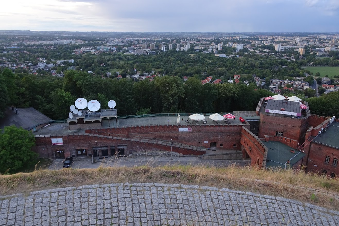
Najbliżej miasta architektura wojskowa wciąż chce być piękna. Fort Kościuszko, otaczający kopiec Naczelnika niczym kamienna korona, jest tego najlepszym przykładem — to fort cytadelowy z lat pięćdziesiątych XIX wieku, który z oddali łatwo pomylić ze średniowieczną warownią. O świcie, kiedy mgła unosi się znad Wisły, jego mury wyłaniają się z niej powoli, a kopiec staje się ciemną sylwetką na rozjaśniającym się niebie. To jeden z tych kadrów, na które warto przyjść wcześnie i poczekać.
Niedaleko stąd, na Wzgórzu św. Benedykta, stoi mały, okrągły Fort 31 „św. Benedykt” — wieża artyleryjska, jakich w Europie zachowało się niewiele. Jej zwarta, cylindryczna bryła wygląda jak szachowa figura postawiona na zboczu. Fotografuje się ją najlepiej w relacji do otoczenia: do trawiastego stoku, do pobliskiego kościółka, do nieba, które nad nią zwykle jest puste i przez to staje się tłem.
Pierścień wewnętrzny: cegła, łuk i geometria
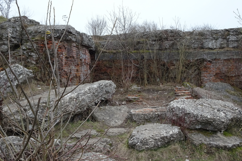
Wchodząc w drugi krąg, wchodzi się w świat ceglanego rzemiosła. Fort 7 „Bronowice”, jeden z najlepiej zachowanych fortów reditowych tego typu, to istna lekcja rytmu: powtarzające się łuki kazamat, regularne otwory, długie korytarze, w których perspektywa ucieka w ciemność. Tu fotografia niemal sama układa się w geometrię. Wystarczy ustawić się na osi sklepionego przejścia, poczekać, aż światło z drugiego końca utworzy jasny punkt, i pozwolić, by łuki prowadziły wzrok.
To miejsca, w których warto pracować z fakturą. Cegła po stu kilkudziesięciu latach nie jest już jednolicie czerwona — jest plamista, porośnięta mchem, miejscami osmalona, miejscami wyblakła. W bocznym, ślizgowym świetle poranka albo późnego popołudnia ta faktura ożywa; w płaskim świetle południa znika. Dlatego forty najlepiej zwiedzać i fotografować na krańcach dnia.
Pierścień zewnętrzny: beton, stal i cisza pól
Najdalej od miasta krajobraz się otwiera. Tu, wśród pól i zagajników podkrakowskich wsi, stoją forty, które były ostatnim słowem ówczesnej techniki. Fort 44 „Tonie” krył pancerne wieże artyleryjskie — zachowały się w nim egzemplarze, których nie ma już nigdzie indziej na świecie. Fort 39 „Olszanica”, powstały najpierw jako ziemno-drewniane dzieło, a tuż przed wojną przebudowany w trwałą fortyfikację, pokazuje z kolei, jak szybko zmieniały się reguły tej gry.
Te zewnętrzne obiekty mają inny nastrój niż ich starsze rodzeństwo. Mniej tu dekoracji, więcej masy. Betonowe stropy, kute progi, ślady po stalowych kopułach. A wokół — przestrzeń, wiatr, szum traw. Fotografując pierścień zewnętrzny, fotografuje się tyleż architekturę, co pejzaż: fort jako ciemna bryła osadzona w łagodnych, rolniczych horyzontach Małopolski.
Drugie życie murów
Najciekawsze jest jednak to, co stało się z fortami później. Większość nigdy nie oddała ani jednego strzału w obronie miasta — historia potoczyła się inaczej, niż przewidywali inżynierowie. Dziś te budowle żyją drugim życiem. Fort 49 „Krzesławice” mieści dom kultury, a jego rewaloryzacja bywa wskazywana jako wzorcowa. Fort 38 „Skała” zamieniono w obserwatorium astronomiczne Uniwersytetu Jagiellońskiego — miejsce, które kiedyś miało patrzeć w stronę nadciągającego wroga, dziś patrzy w gwiazdy.
Inne forty pełnią rolę magazynów, siedzib stowarzyszeń, planów zdjęciowych, a niektóre — najbardziej fotogeniczne dla miłośników ruin — wciąż stoją puste, zarastając samosiejkami, z drzewami wrastającymi w korony murów. Wszystkie połączono Szlakiem Twierdzy Kraków, oznakowanym żółto-czarno-żółtymi znakami, który prowadzi przez kolejne obiekty po obu stronach Wisły.
Sztuka patrzenia na fort
Forty uczą cierpliwego widzenia. Nie odsłaniają się od razu; trzeba je obejść, znaleźć oś, poczekać na światło, wejść w cień i pozwolić oczom przywyknąć. Nagradzają tych, którzy wracają o różnych porach roku — bo inny jest fort latem, utopiony w zieleni, a inny w listopadzie, gdy bezlistne drzewa odsłaniają jego pełną sylwetkę i gdy mgła robi z fos jeziora pary.
W gruncie rzeczy każdy z tych obiektów jest zdaniem napisanym przez czas. Najpierw przez inżynierów, którzy liczyli kąty ostrzału i grubość stropów. Potem przez wojnę, która ich nie potrzebowała tak, jak się spodziewano. Wreszcie przez naturę i miasto, które razem przepisały ich znaczenie. Wchodząc w bramę fortu, wchodzimy w to zdanie w połowie. Aparat — albo szkicownik, albo po prostu uważne oko — pozwala je dokończyć po swojemu.
I może o to właśnie chodzi w tych pierścieniach ciszy wokół Krakowa: że są zaproszeniem, by spojrzeć jeszcze raz.
Rings of Silence. The Forts of the Kraków Fortress
The first thing that changes is the sound. You walk along an earthen rampart, pass a row of old hornbeams, then step into the shadow of a gateway — and the world goes quiet, with that particular silence that thick brick walls hold inside them. The air drops a few degrees. Gravel crunches underfoot, water drips somewhere in the dark, and the light, broad and summery a moment ago, now falls in a narrow blade through an embrasure. This is the first thing Kraków’s forts teach the eye and the ear: that fortification was, above all, the art of mastering space, light and silence.
Dozens of such places are scattered around Kraków. Together they form one of the largest and best-preserved fortification complexes in this part of Europe — the Kraków Fortress, Twierdza Kraków. It is not a single castle or a lone redoubt but an entire system, spread across an area of more than five hundred square kilometres, a ring of structures that wrapped the city in ever-wider circles over several decades.
A city in three circles
The story begins in the mid-nineteenth century. After the upheavals of 1848, Austria decided to turn Kraków — then a border city of the monarchy — into a first-class fortress. The order to build the fortifications was issued in 1850, under Emperor Franz Joseph I, and for the next sixty-odd years, right up to the First World War, the fortress grew, matured and kept adapting to the relentless progress of artillery.
From that tension — between the wall and the shell meant to break it — came its three-ring structure. At the centre lay the core: works pressed up against the city itself. Beyond it ran an inner ring, and finally, pushed several kilometres out, an outer ring of powerful, free-standing armoured artillery forts. Each circle is a different chapter in the history of engineering: the further from the centre and the later the structure, the less romantic brickwork it shows and the more concrete, steel and cold calculation.
For anyone arriving here with a camera, this chronology is a gift. You can photograph the forts as layers of time — from the detailed, almost palatial façades of the 1850s to the austere, geometric masses built just before 1914.
The core: forts that pretend to be castles
Closest to the city, military architecture still wants to be beautiful. Fort Kościuszko, wrapped around the mound of the Polish national hero like a stone crown, is the clearest example — a citadel fort from the 1850s that, from a distance, is easy to mistake for a medieval stronghold. At dawn, when mist lifts off the Vistula, its walls emerge slowly and the mound becomes a dark silhouette against a brightening sky. It is one of those frames worth arriving early for, and waiting.
Not far away, on St Benedict’s Hill, stands the small, round Fort 31 “St Benedict” — an artillery tower of a kind few have survived in Europe. Its compact cylindrical body looks like a chess piece set down on the slope. It photographs best in relation to its surroundings: the grassy incline, the little nearby church, the sky above it that is usually empty and therefore becomes a backdrop.
The inner ring: brick, arch and geometry
Stepping into the second circle, you enter a world of brick craftsmanship. Fort 7 “Bronowice”, one of the best-preserved reduit forts of its type, is a lesson in rhythm: repeating casemate arches, regular openings, long corridors in which perspective runs away into darkness. Here a photograph almost composes itself into geometry. Stand on the axis of a vaulted passage, wait for the light at the far end to form a bright point, and let the arches lead the eye.
These are places to work with texture. After more than a century the brick is no longer uniformly red — it is mottled, moss-grown, scorched in places, bleached in others. In the raking light of early morning or late afternoon that texture comes alive; in the flat light of noon it disappears. Which is why the forts are best seen, and photographed, at the edges of the day.
The outer ring: concrete, steel and the silence of fields
Furthest from the city, the landscape opens. Here, among the fields and copses of the villages around Kraków, stand the forts that represented the last word in the technology of their time. Fort 44 “Tonie” once held armoured artillery turrets — surviving examples of a type found nowhere else in the world. Fort 39 “Olszanica”, first raised as an earth-and-timber work and rebuilt into a permanent fortification just before the war, shows in turn how quickly the rules of this game were changing.
These outer works have a different mood from their older siblings. Less ornament, more mass. Concrete ceilings, forged thresholds, the scars left by steel cupolas. And all around — space, wind, the rustle of grass. To photograph the outer ring is to photograph landscape as much as architecture: the fort as a dark mass set into the gentle, agricultural horizons of Lesser Poland.
The second life of the walls
The most interesting thing, though, is what became of the forts later. Most never fired a single shot in the city’s defence — history unfolded differently from the engineers’ calculations. Today these structures live a second life. Fort 49 “Krzesławice” houses a culture centre, and its restoration is sometimes cited as a model. Fort 38 “Skała” was turned into an astronomical observatory of the Jagiellonian University — a place once meant to watch for an approaching enemy now watches the stars.
Other forts serve as warehouses, as homes for associations, as film locations; and some — the most photogenic for lovers of ruins — still stand empty, overgrown, with trees rooting into the crowns of their walls. All are linked by the Kraków Fortress Trail, marked with yellow-black-yellow signs, which leads from one structure to the next on both banks of the Vistula.
The art of looking at a fort
The forts teach patient seeing. They do not reveal themselves at once; you have to walk around them, find the axis, wait for the light, step into the shadow and let your eyes adjust. They reward those who return in different seasons — for a fort in summer, drowned in green, is a different thing from a fort in November, when leafless trees expose its full silhouette and mist turns the moats into lakes of vapour.
In truth, each of these structures is a sentence written by time. First by the engineers who reckoned angles of fire and the thickness of ceilings. Then by a war that did not need them as expected. Finally by nature and the city, which together rewrote their meaning. To step through a fort’s gateway is to enter that sentence halfway through. A camera — or a sketchbook, or simply an attentive eye — lets you finish it in your own way.
And perhaps that is what these rings of silence around Kraków are really for: an invitation to look once more.
